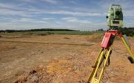
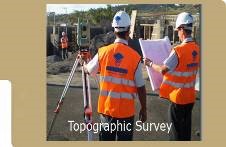
ACC offers a wide range of survey services such as topographic surveys using the latest dual frequency GPS rover systems, satellite imagery acquisition and processing, hydrological and ground water surveys, soil and water quality surveys and resource development surveys.
ACC was awarded a global contract for carrying out the topographic surveys for all the National Highway network projects in Pakistan.


Surveying Equipment ACC has a team of highly experienced and qualified survey staff. This staff is fully capable of carrying out all kinds of highway and structure related surveying assignments. ACC owns the following survey equipments, sufficient to field seven parties simultaneously:
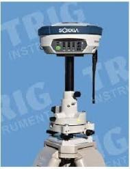
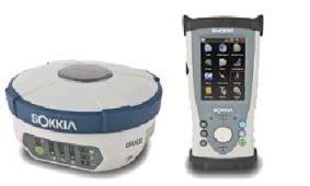
GPS with one base and one rover, Kit pox GRX2 digital UHF ii, Antenna, UHF 450-470 male BNC, magnetic field GPS, magnetic office tools plus post processing SHC 250/ENG, SHC 250 data controller
GPS with one base and one rover, Kit pox GRX2 digital UHF ii, Antenna, UHF 450-470 male BNC, magnetic field GPS, magnetic office tools plus post processing SHC 250/ENG, SHC 250 data controller
Measuring range with one prism 3000m. Wireless data transfer, complete with standard accessories, carrying case and dual prism target with pole adapter and pole.
Measuring Range with One AP01 prism 2200m (7220 ft.). with infrared and complete standard accessories, carrying case and dual prism target with pole adapter and Pole.
Powerful, expandable, pocket-sized mapping GPS. SD-card expandability and USB port offer unlimited map, waypoint and track log storage. Geocache Manager enables easy download and use of coordinates from Web sites.
GPS, SportTrack Map (Magellan) 3 Nos.
Powerful, expandable, pocket-sized mapping GPS. SD-card expandability and USB port offer unlimited map, waypoint and track log storage. Accurate to a 3 meters (WAAS), 12 parallel Channels, Store upto 500 waypoints and 20 routes
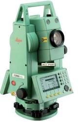
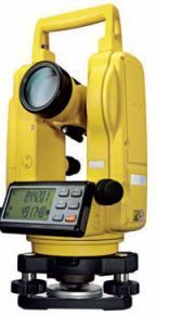
TL-10F Optical Theodolite five seconds reading complete standard accessories and carrying case
Automatic Levels AT-G7 20 Nos.
Automatic Level magnification 22X, water and dust proof complete with standard accessories and carrying out case.
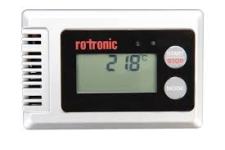
Electronic Data Loggers 3 Nos.
TL-10F Optical Theodolite five seconds reading complete standard accessories and carrying case
Automatic Levels AT-G7 20 Nos.
Automatic Level magnification 22X, water and dust proof complete with standard accessories and carrying out case.
Electronic Data Loggers 3 Nos.